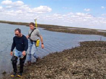
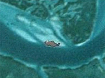
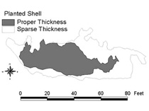
Increased reef area is important for oyster production and associated faunal diversity and can create a buffer against physical disturbances. Typically, reef size is measured as the total footprint of the reef (m2) and may include an estimate of the percent cover of oysters (see Figure). The perimeter of intertidal reefs can be measured by walking the edge of the reef with surveying equipment. Indirect and direct methods for mapping subtidal reefs include digital side-scan sonar, towed video and diver sampled quadrats. Images can be processed to determine bottom types and the percent coverage of oyster clusters and shells. Data can be integrated into a Geographical Information System (GIS) and changes followed over time.


The size of intertidal reefs can be delineated using GPS survey system (e.g., Trimble) (top left). Surveys can measure changes in reef size over time (top right and bottom) (photos from L. Coen).


